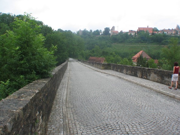
WIKIPEDIA: The Tauber bridge Rothenburg ob der Tauber is a historic road bridge, spanning the Tauber West of the Centre of the Middle franconian town Rothenburg ob der Tauber, lying. The building convicted a 4.0 m wide roadway, and a 1.0 m wide walkway one municipality road after Leuzenbronn and the Tauber Valley trail.
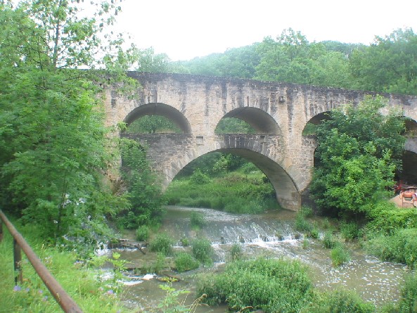
The double bridge with two rows of each other standing bow was probably built around 1330. It lies at the foot of the South-western slope of the Tauber below of Rothenburg ob der Tauber and was part of a trade route between Augsburg and Würzburg. At construction, a repair from 1791 is known after the four upper arches collapsed a year earlier. In 1925, an extension of the Eastern bridge ramp followed and twenty years later the building was blown up by German troops. The reconstruction was completed on November 10, 1956 after a good year of construction.
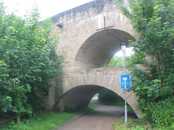
The stone arch bridge has a limestone masonry, the 45 cm thick parapets are 123 m long. Since the reconstruction of 1956 bridge is 6.4 m wide, before there were 5.4 m. To the West, the building has a longitudinal gradient. Therefore, only an arch, which spans the Mill Creek of Mr mill, at the western end is arranged with 12.5 m clear span. Wide pillars of the double-deck bridge section, followed by a 5.0 m East its top nine arches does not rule on the lower six sheets are available. The upper arches have a circular shape and clearance distances between 5.8 and 6.2 m in a growing with the road gradient arrow height of 2.3 m to 3.0 m below a 11.5 m clear span in the foothills of the Eastern arch is arranged, over the Tauber followed by two more wide lights with 12.2 m and 11.4 m and light height 5.66 m. These two River piers are wide in between 4.5 m. In the Eastern foothills, a 1.75 m wide piers and 8.5 m wide arch, which straddles a walkway, is attached. Two more arches complete the bottom row of the arc with 6.3 and 5.6 m clear span.