BAS 1631
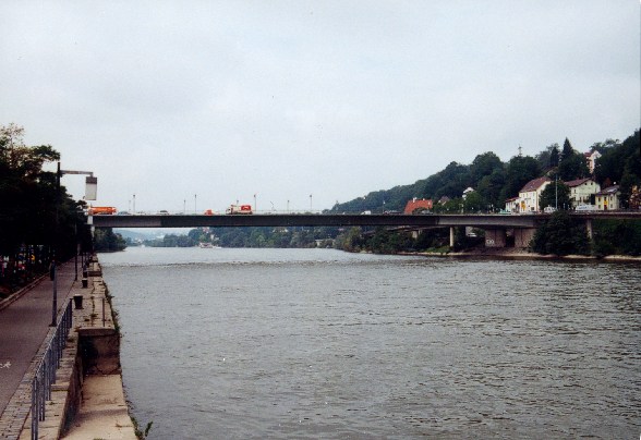
Schanzlbruecke
© www.brueckenweb.de / Monika Sellke

© Uwe Urtel
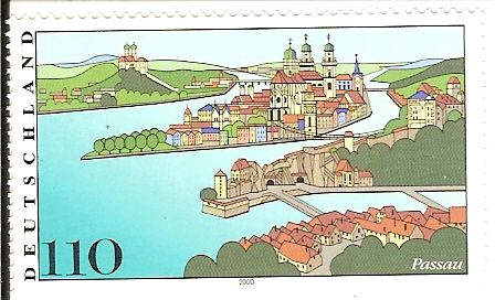
Schanzlbrücke 110 Pfennigbriefmarke aus Deutschland Die hintere Brücke am mittleren Fluß auf der Marke zeigt diese Brücke
Ausgabe 2000
© Helmut Fischer
Germany
Bavaria
Passau
Centrum
Danube
Road B12 and B388
Girder bridge
Steel
1968-1970
149.00 m
250.00 m
0.00 m
0.00 m
0.00 m
0.00 m2
in operation
WIKIPEDIA: The Schanzlbrücke is the largest bridge of area and crosses the Danube at height of the "new Center" at River kilometre 2226,98. The Castle Eggendobl, the Castle Church and defensive wall in the construction of the bridge were demolished is located at the northern entrance.
The construction of the bridge was decided on January 13, 1961 by the City Council. Construction began in 1968, with the onset of the middle section of Structual works completed on February 21, 1970 and was celebrated the topping-out ceremony on 18 March.
After a stress test on 19 September 1970, the inauguration took place on October 14 in the presence of the former Transport Minister Georg Leber. With the release of traffic through the Schanzlbrücke, the existing since 1823, located about 300 m East Max bridge for car traffic was blocked and dismantled in 1972.
A map is loading